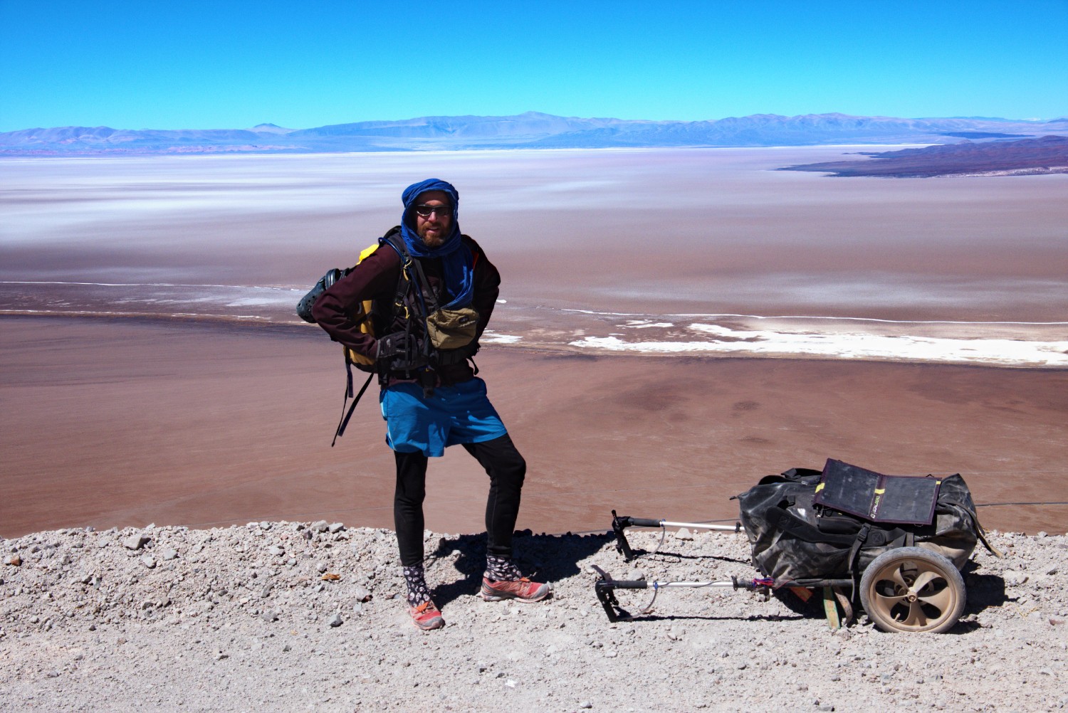
There it was - the mixed feeling of fascination, motivation, respect, excitement, joy and fear. It was August 2016 and I stood in the middle of a dirt road close to the town of Peine, approximately 100 km south of San Pedro de Atacama, Chile. Food for roughly 2 weeks and 22 liters of water were stowed on my hiking trailer.
The weeks before, I walked across the Altiplano from the town of Uyuni in Bolivia over a distance of 600 km down to San Pedro in Chile. So after this amazing experience, the ultimate showdown should be Paso Socompa (translated: the other side) - the terrifying legend amongst the long-distance bicycle community in South America.
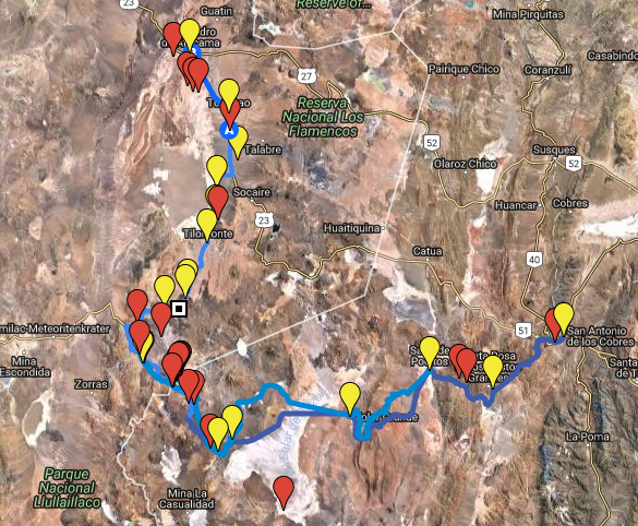
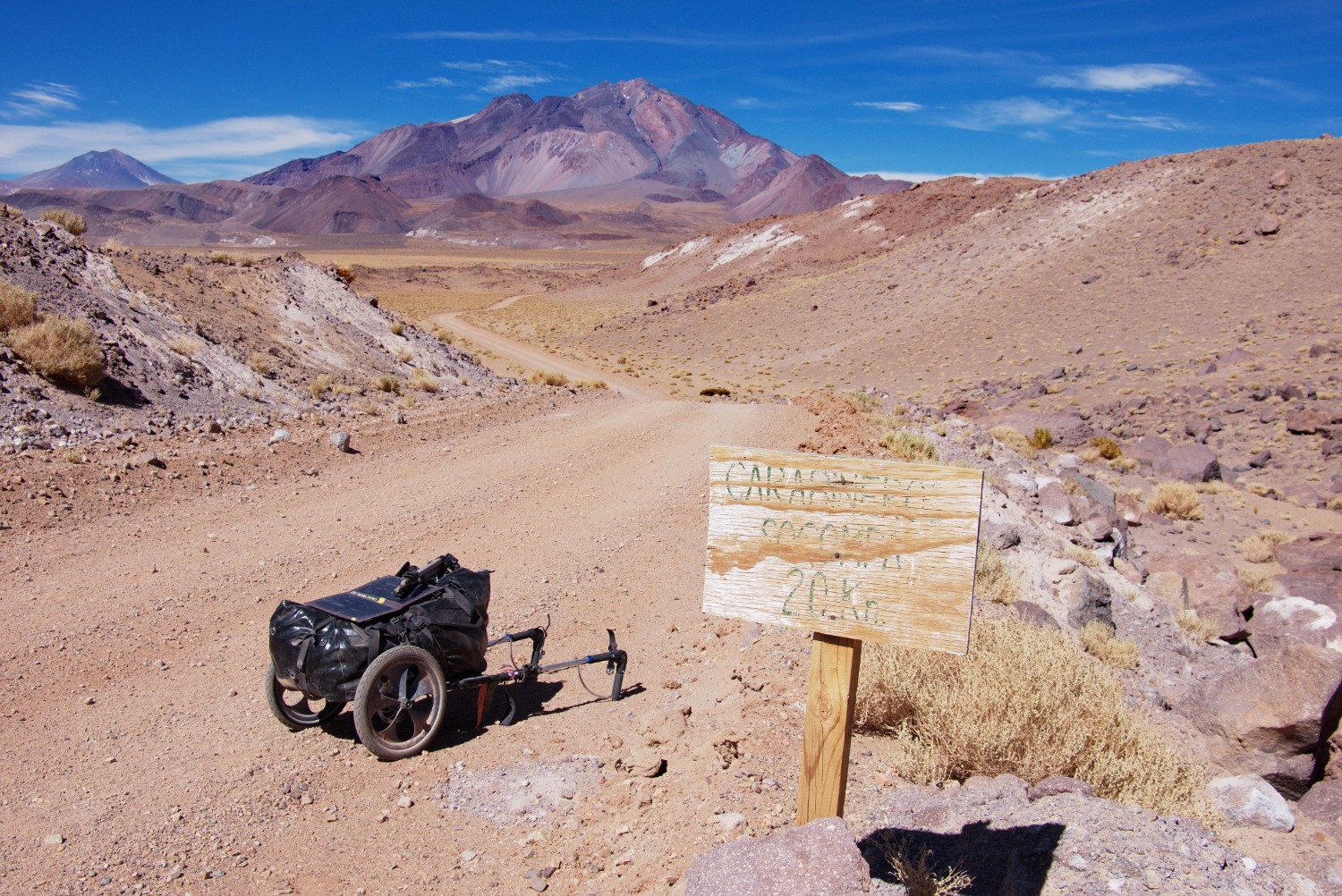
Route Overview
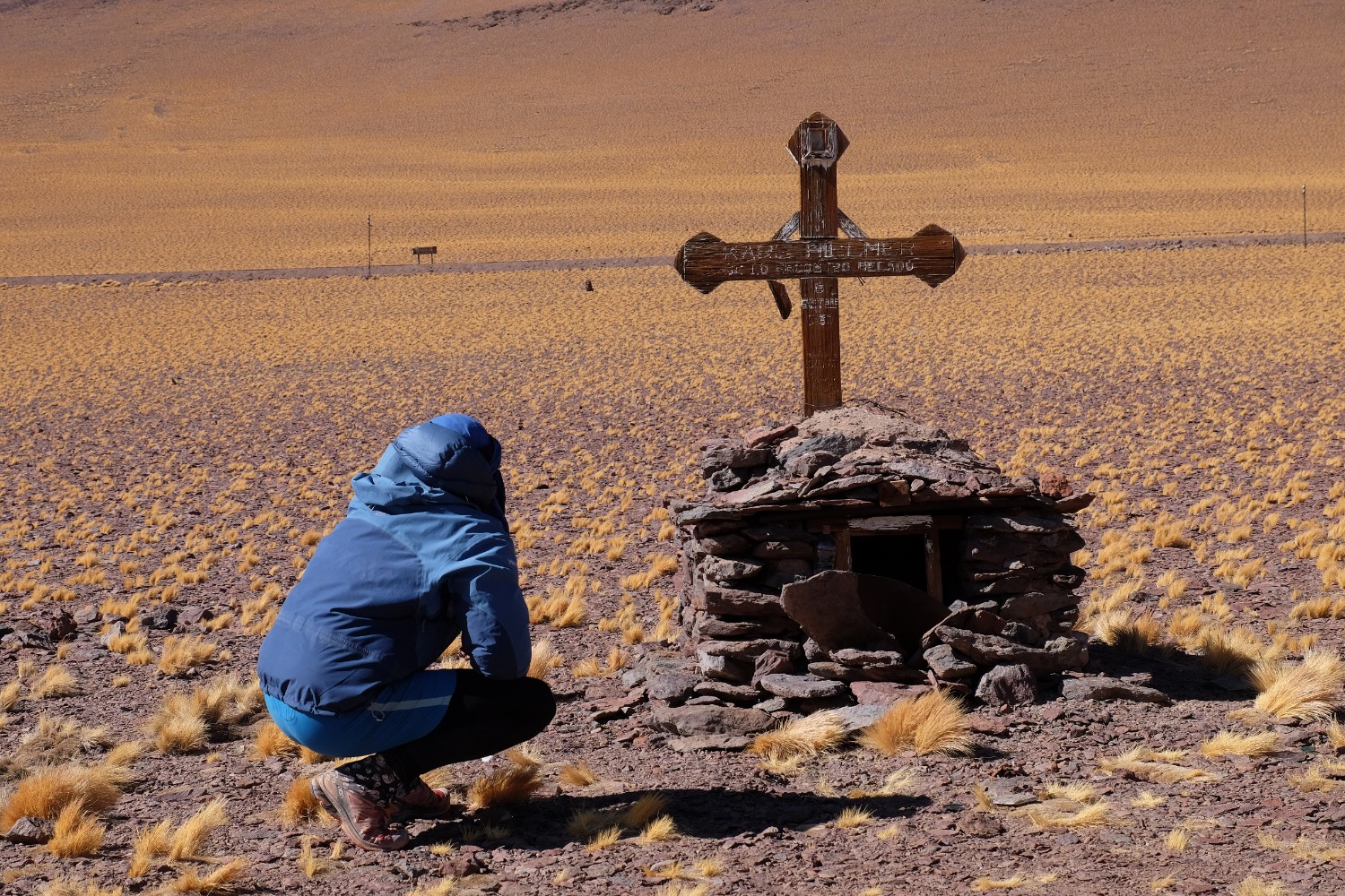
I felt ready for this final adventure and had a solid plan already prepared the months beforehand - as it turned out, I was able to put most of my plan into reality: After crossing parts of the outskirts of the Atacama desert south of Peine, I climbed up the lonely road of Paso Socompa, partly using old railway tracks as shortcuts, until I reached the border military station between Argentina and Chile. From there, I descended into Argentina, visiting the tomb of the “aleman muerto” Karl Wilmer who died in a whiteout in the 1930s on a 4300 m mountain pass, until I reached the Salar de Arizaro, the 2nd biggest salt lake in Argentina. I was about to cross the salar from West to East, when the military picked me up and brought me to Tolar Grande by 4x4 vehicle. So I got a free pickup for the last kilometers - more below.
All in all the total distance was about 250 km divided by the border military after approx. 130 km. The border station was also the only inhabited outpost on the complete trip and a safe place to count on water resupply. Regarding food, there was no official possibility to resupply over the stretch of the 250 km.
The trip can be done in 10 days - or even less depending on your performance and the extras you want to do (from the border station, you can even climb the Socompa Peak at 6051 m altitude) which I couldn’t due to lack of food supplies and time - perhaps next time.
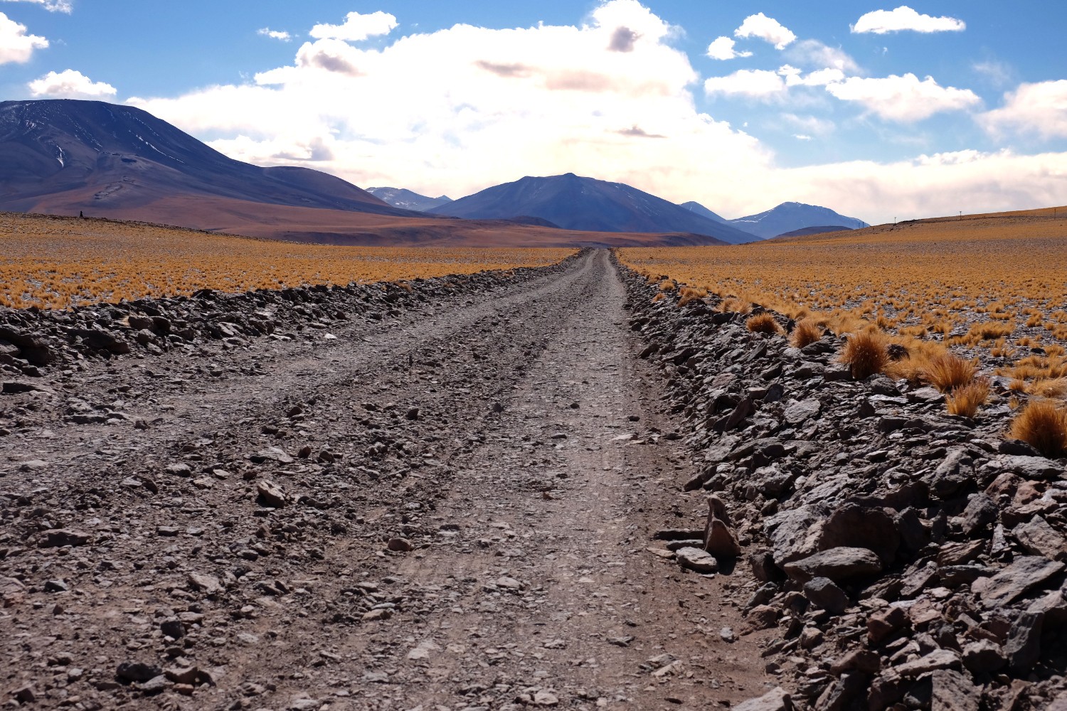
Section 1: Tilomonte to Border Station at Paso Socompa
Environment / Trail Conditions:
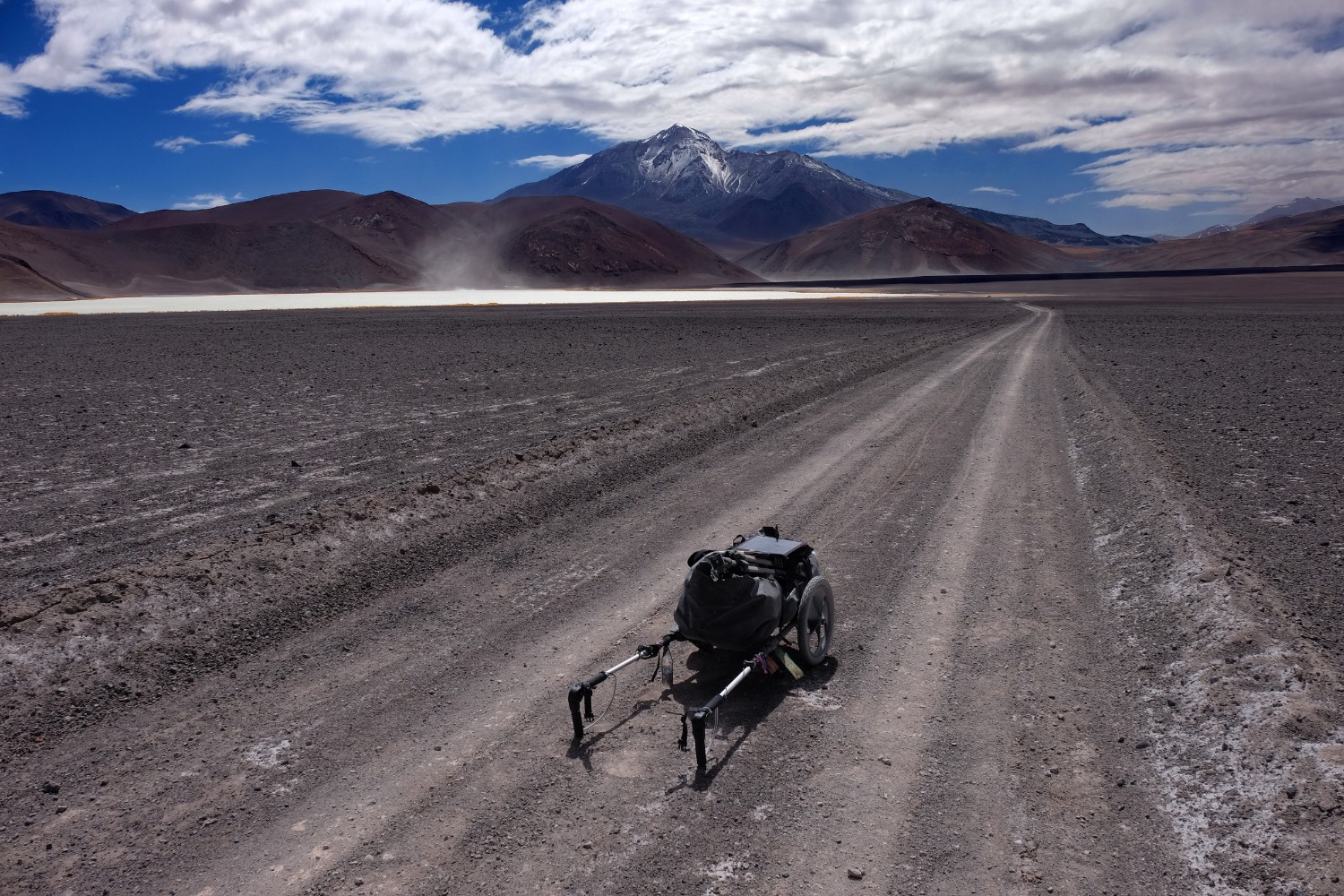
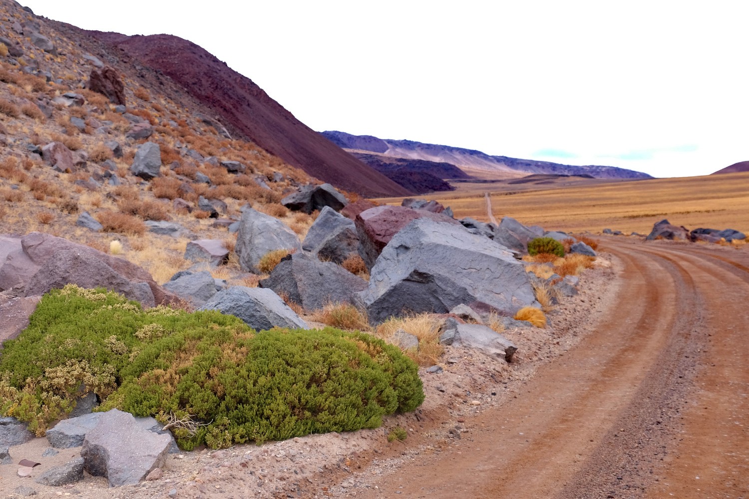
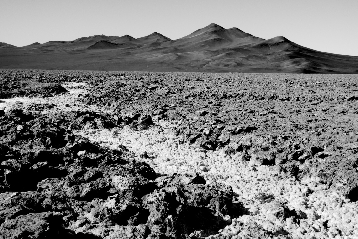
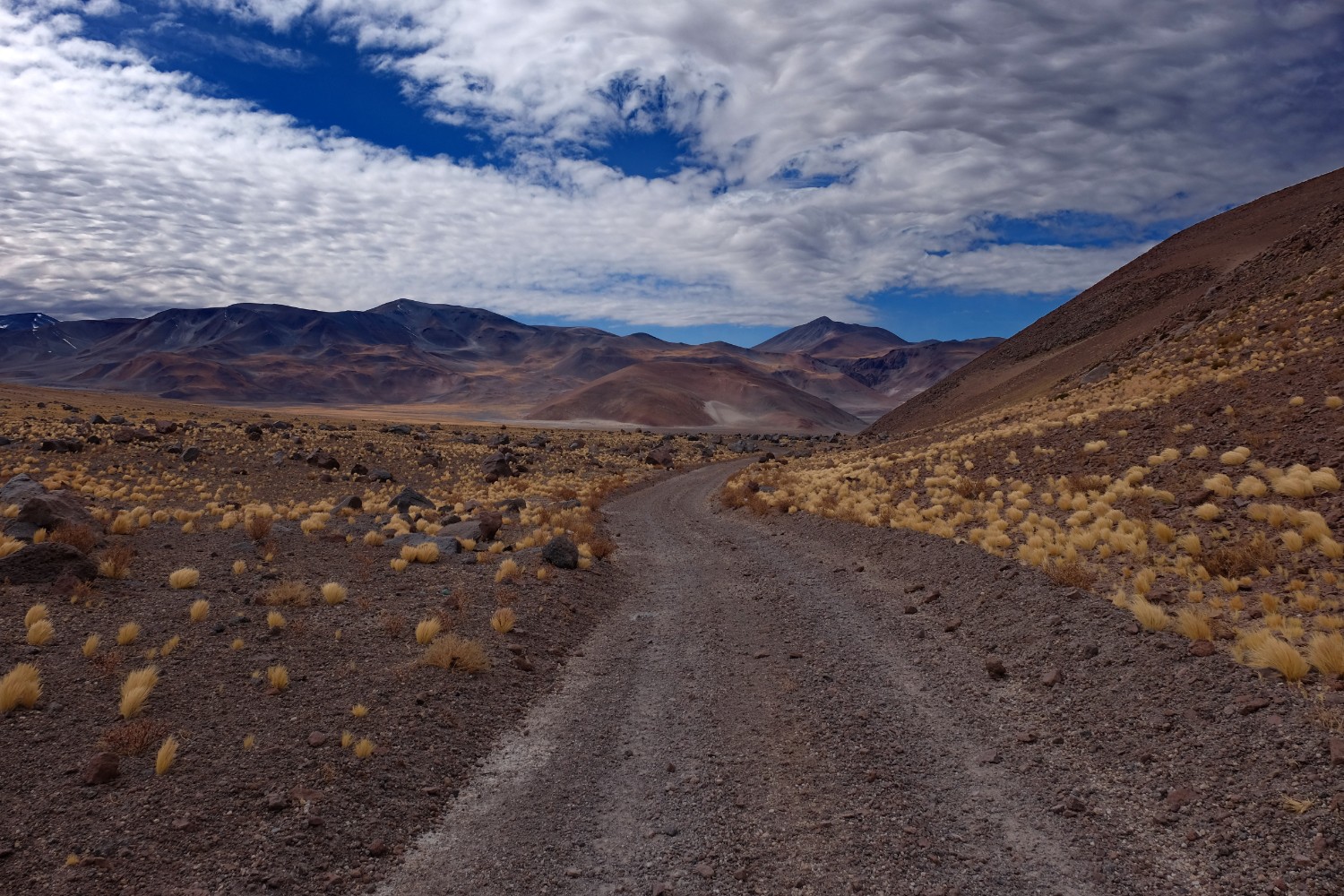
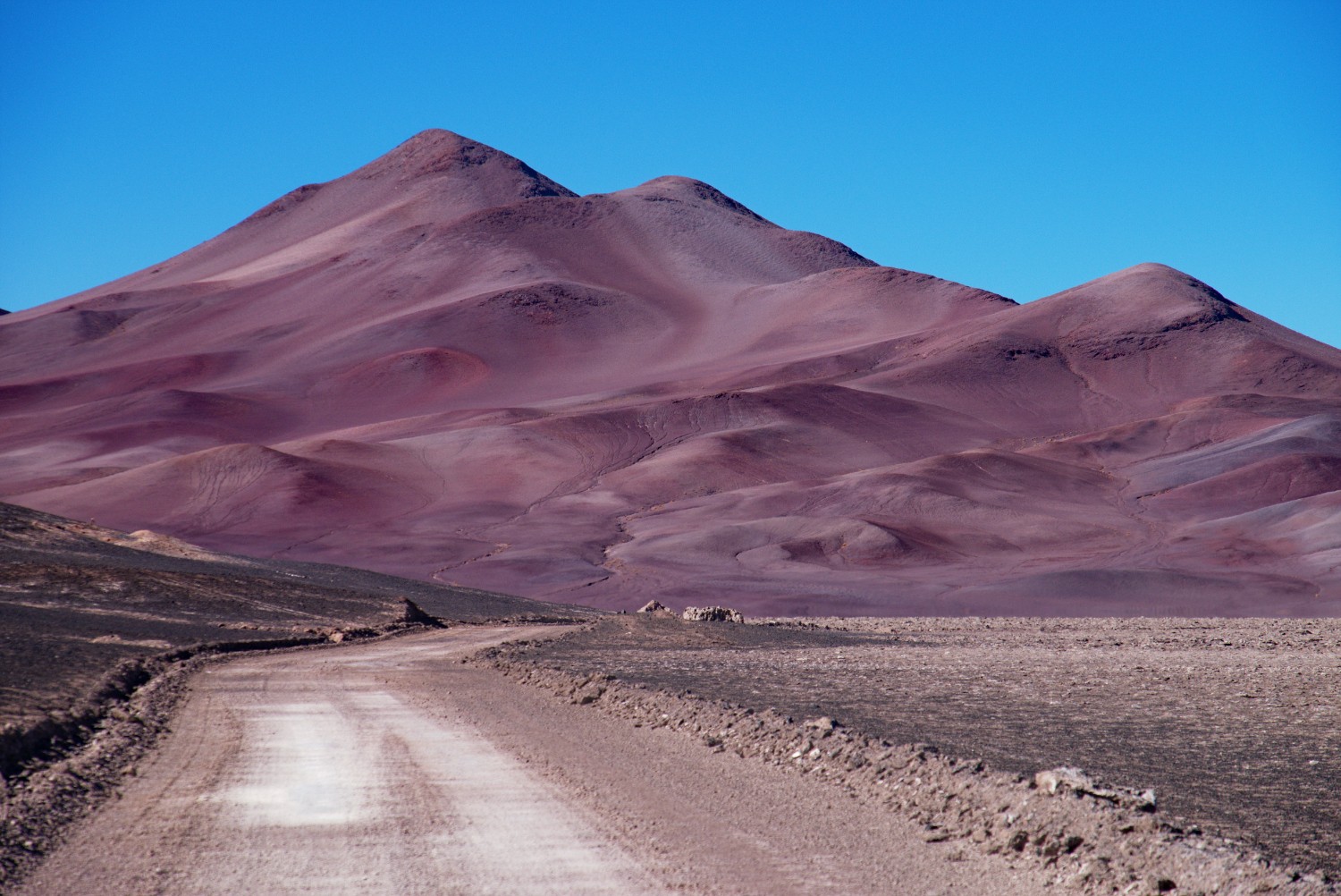
The trail contains typical dirt road conditions, similar to the Altiplano trip, and is therefore perfectly made for the Benpacker Hiking Trailer. The climate, especially during the first 80-90 km, is very dry with potential hot days (25-30 C) and mild nights around 0/-10 C. It will get colder ![]() as soon as we climb up to Paso Socompa. But when I say dry, I mean really dry: The Atacama is commonly known as the driest non-polar place in the world. The sun is a threat in the same way as it was on the Altiplano - what got worse, was the dust. Important to notice is the possibility to short-cut the 4x4 trail by using the railroad tracks that go up to the mountain pass as well. The landscape in the beginning is quite desert-like with small hills and therefore a lot of “up and down” hiking. This changes as soon as you climb and reach automatically a more Puna-like landscape.
as soon as we climb up to Paso Socompa. But when I say dry, I mean really dry: The Atacama is commonly known as the driest non-polar place in the world. The sun is a threat in the same way as it was on the Altiplano - what got worse, was the dust. Important to notice is the possibility to short-cut the 4x4 trail by using the railroad tracks that go up to the mountain pass as well. The landscape in the beginning is quite desert-like with small hills and therefore a lot of “up and down” hiking. This changes as soon as you climb and reach automatically a more Puna-like landscape.
Main Challenges:
- Heat - Until you reach the way up to the Socompa Pass, you will cross desert landscape and the days can be comparatively hot especially in the sun. So you need to consider this situation during your planning stage especially in terms of water supplies. The desert part was one of the main reasons why I took 22 liters - to be on the safe side. Additionally, I tried to get through it as fast as possible.
-
Solitude - you will hardly meet any people out there (except for people working in the mines if you are really lucky). Since the Paso Socompa is only open for hikers and bicycles, there are no cars, motorbikes etc. The soldiers at the border told me that I was the first person in 2016 (I also found no other entries in the guest book for 2016) and the first hiker for years (if any). So be ready to meet your best friends our there: sun
 , dust, cold
  and solitude.
-
Manage your water/food supplies - water is scarce and there is no way to resupply with food during the whole trip. But your primary challenge is water - this is completely different and much more difficult than it was on the Altiplano in Bolivia. So you need to plan properly, considering the different circumstances such as heat, altitude etc. - luckily, the bicycle community identified some springs from which you can take water from on the way - theoretically. Unfortunately, both sources listed below turned out to be dry (August 2016)! I didn’t rely on additional water sources due to the 22 liters I carried on my hiking trailer so this wasn’t a problem for me. A 3rd water source in Monturaqui, approx. 20 km away from the border, has a well with water. However, since I didn’t need any water and the location is close to the border anyway, I can’t say whether it is drinkable or not. I recommend filtering in any case. (GPS:
-24.34325, -68.43785). A final 4th chance is to meet some mining people at this outpost here - but I can’t say whether this is a permanent one or not:-24.09011, -68.25458. So I would not rely on this one at all. Those 2 coordinates are available from the bicycle community and I found them dry.- POZO 6:
-24.01954, -68.21568 - POZO 4:
-24.04672, -68.22391
- POZO 6:
- Sun - be careful if you heavily rely on blue sky for your electricity supply via solar panels. On the pass, I had 2-3 days of clouds and heavy wind - the weather was quite similar to the Scottish Highlands in spring except for the lack of rain.
-
Visa Entry - in case you come from San Pedro it is not needed to do any exit formalities beforehand. I heard some rumors that some visa work has to be done beforehand, but I can’t confirm that this was the case in August 2016. So you can do all formalities up on the pass. However, what you need to be prepared for is the following:
- In August 2016, only the Chile border military was around - the Argentinian border station was closed. I heard that the Argentinian military will come up to the pass again in October when it’s warmer. :simple_smile:
- So I basically got an exit stamp from the Chile folks, but no entry stamp on the Argentinian side. This situation remained the same until I was back in Salta where I had to pay a penalty of 40,- USD but could enter and exit Argentina properly. You cannot do these formalities in San Antonio de los Cobres, so you need to head back to Salta. As soon as the Argentinian military returned to the pass, things will be easier I suppose.

Further Tips:
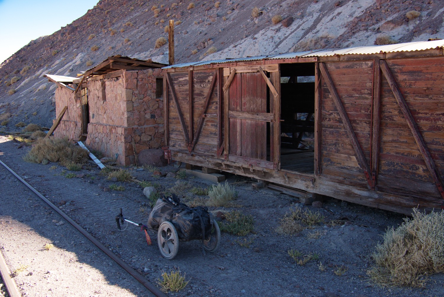
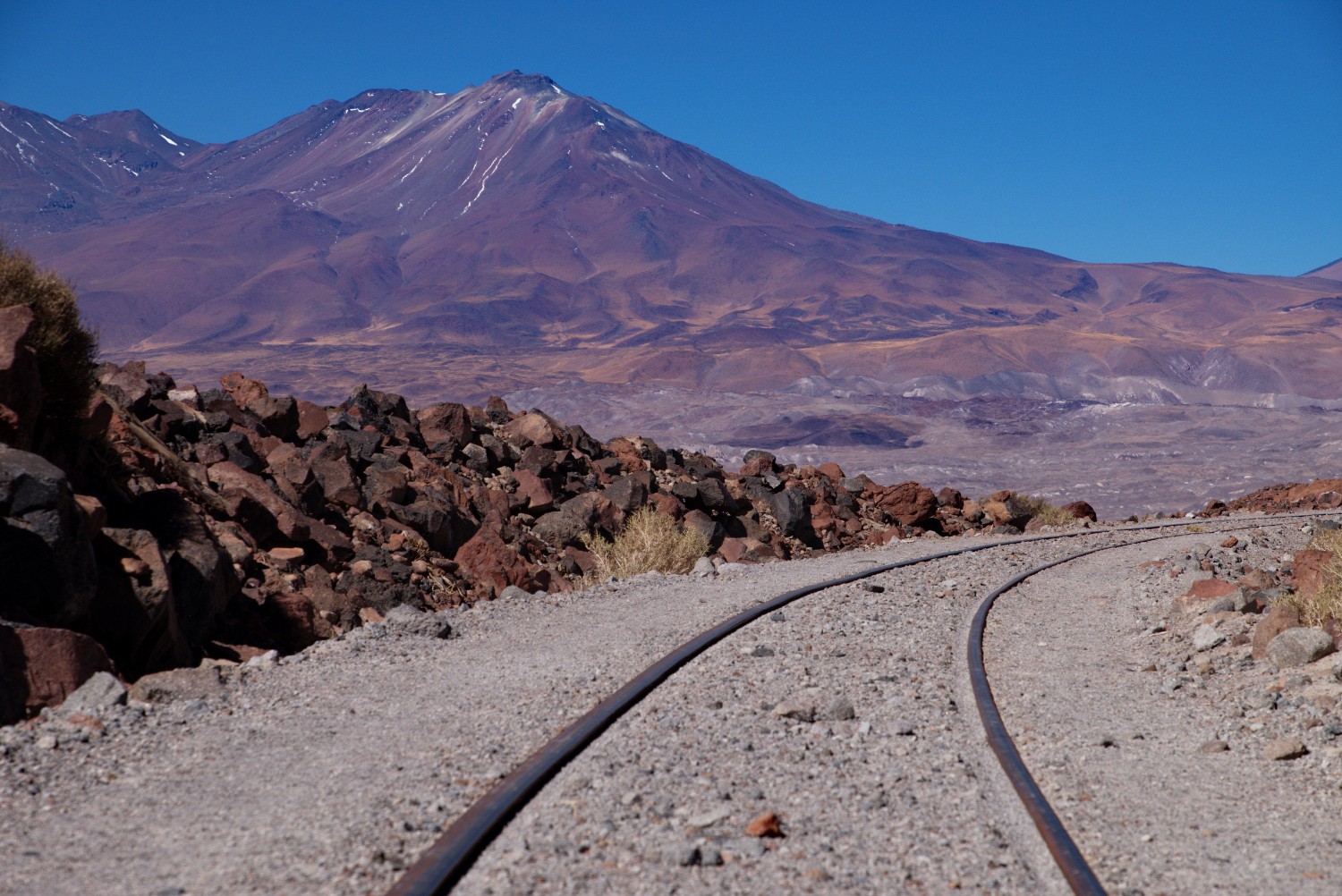
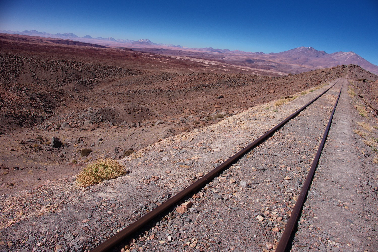
- A possibility exists to do a short-cut via the railroad tracks and by doing so, get rid of some ascending/descending. The railroad tracks are part of the train system that crosses the Atacama desert and climbs up over the Socompa from where it continues until San Antonio de los Cobres in Argentina. During August 2016, this railroad system was used approx. once a month according to the border military. Unfortunately I missed the passing train since I was camping far away from the railroad the night the train went through. But hiking on those old railroad tracks is magical! And I can highly recommend to do so - additionally, it is easy hiking since the train does normally not climb steeply and the old train stations are mystical as well as provide shelter for the cold nights.
- Get on railroad tracks:
-24.16428, -68.46683 - Get off the railroad tracks back on the 4x4 trail:
-24.30095, -68.4533
- Get on railroad tracks:

- For the folks interested in history: The Puna de Atacama region was subject to war in the late 19th century called “The Puna de Atacama Dispute”.
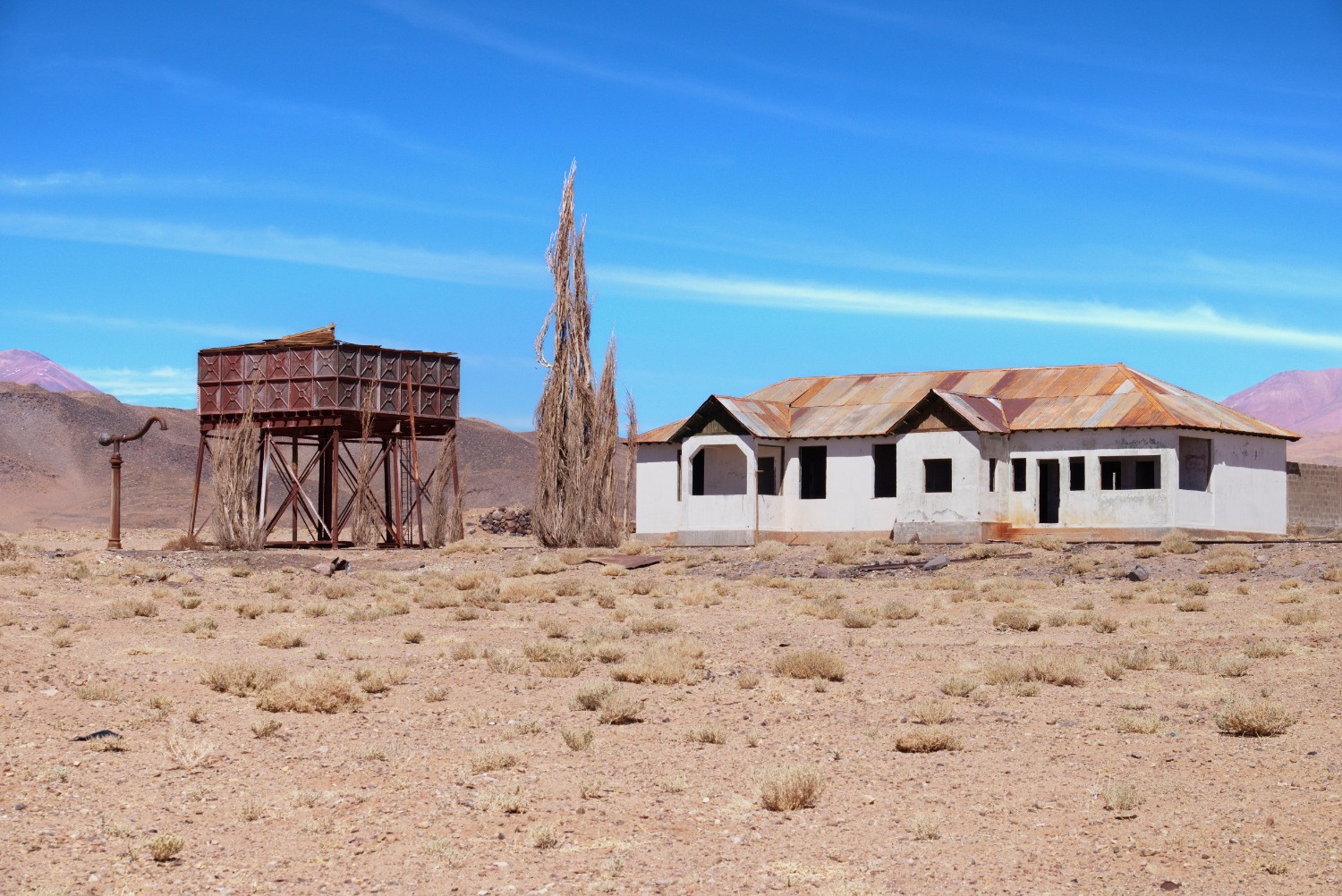
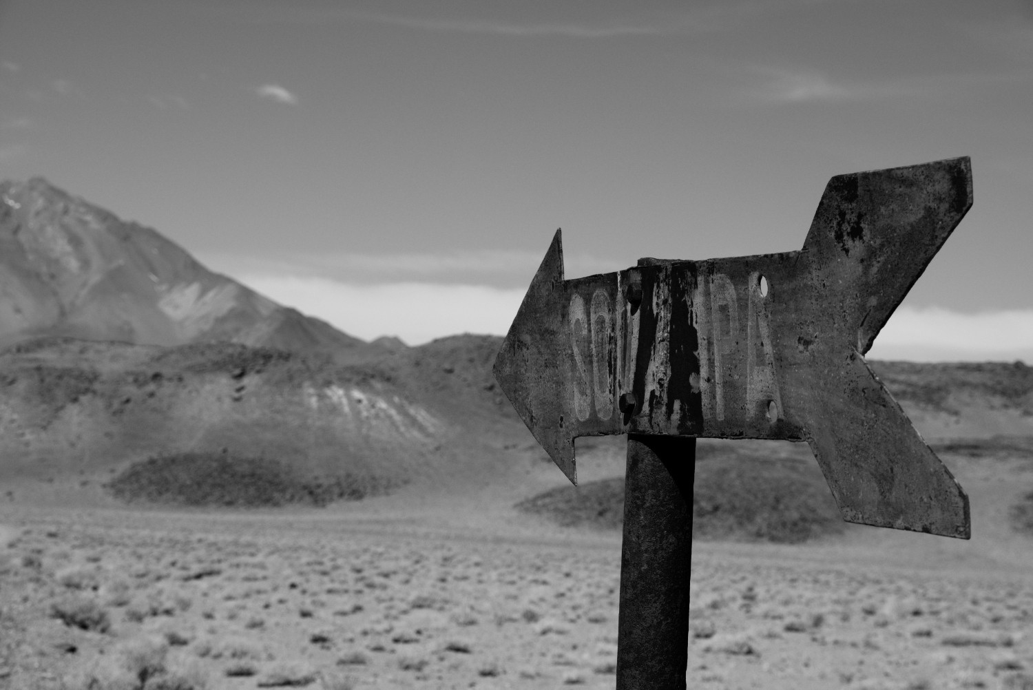
- The Paso Socompa station is basically a small collection of locked, abandoned houses - the first one on the left coming from Chile is the Chile border station although it doesn’t look like it. You will meet super friendly people up there.
- If you are lucky and at the right time at the right place, you can ask to get a ride on the train - I wanted to do that but as mentioned, missed it. This must be an awesome adventure. There are no passenger trains but only freight trains.
Section 2: Border Station at Paso Socompa to Tolar Grande
Environment / Trail Conditions:
During this section, surface conditions remain the same but you will have to fight with heavy tail- as well as headwinds. Furthermore, the temperatures in the mountains can drop below -20 C and the strong winds can create arctic conditions also during the day. Water still remains one of the biggest challenges - but at least you will not encounter warm/hot days anymore. Perhaps you will get a cloudy sky on some days so be prepared in terms of power management for your electronic devices.
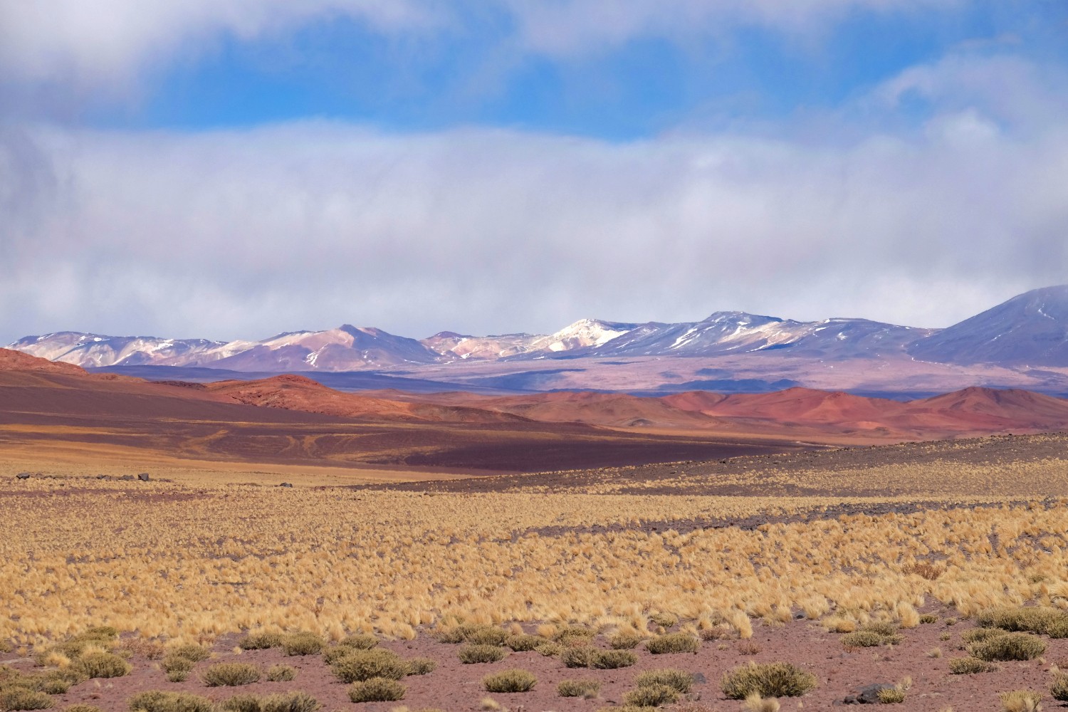
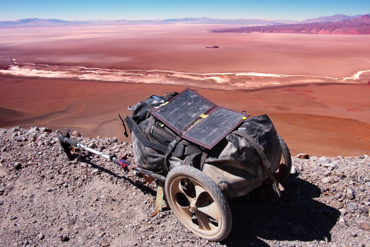
Additionally, you will pass Laguna Socompa, lately subject to several scientific studies in regards to stromatolites. These fellows are photosynthetic microorganisms that have been discovered in a rare find in the Laguna Socompa.
Quote from the Nature article:
In the lakes, where salt levels are more than 135 parts per million and nitrate levels are high, the stromatolites have no competition for nutrients and can thrive. The high elevation means that there is relatively little oxygen in the atmosphere, and levels of ultraviolet radiation can be 165% that of sea level. “This environment is similar to the one in which stromatolites originally developed,” says Farías.

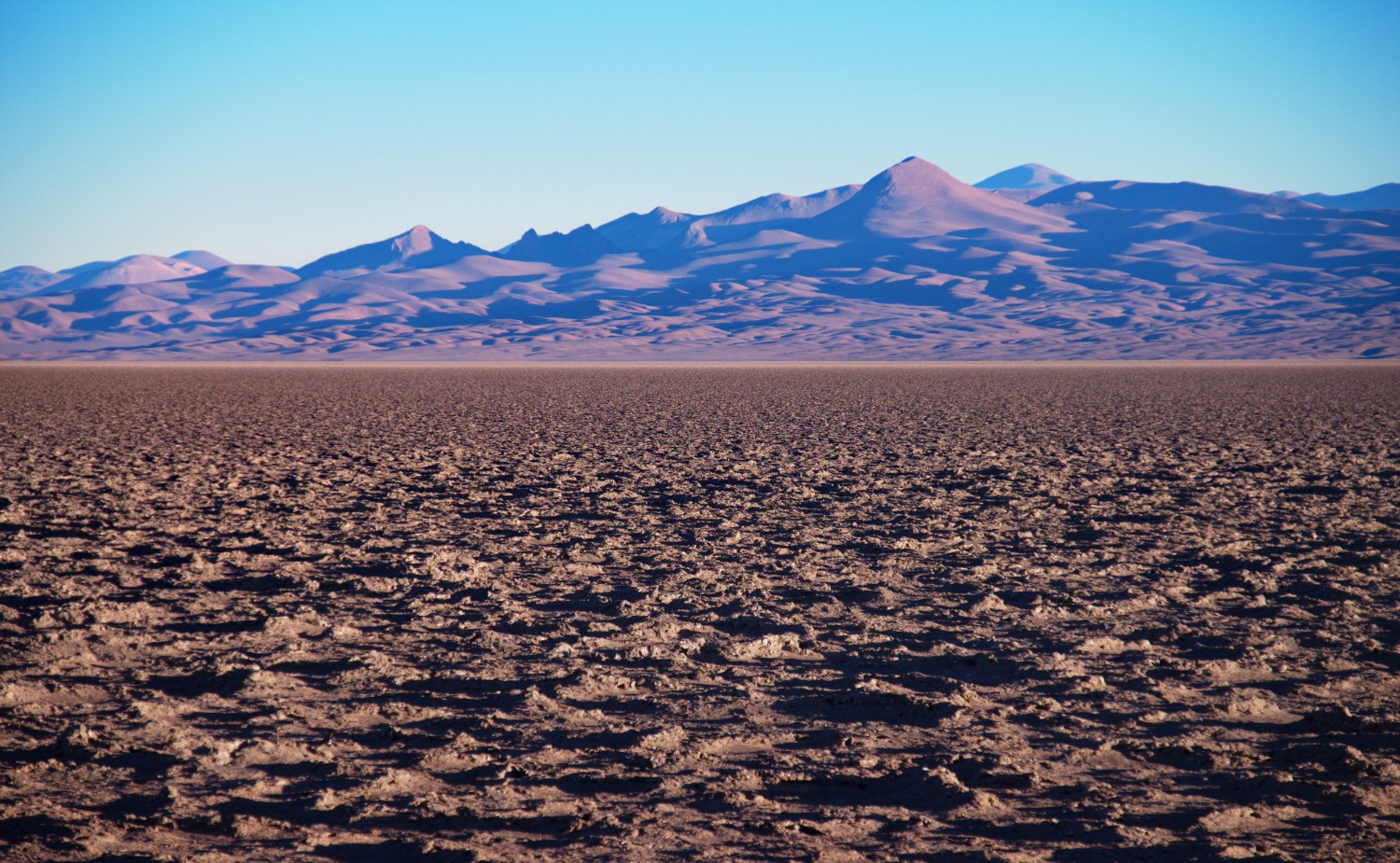
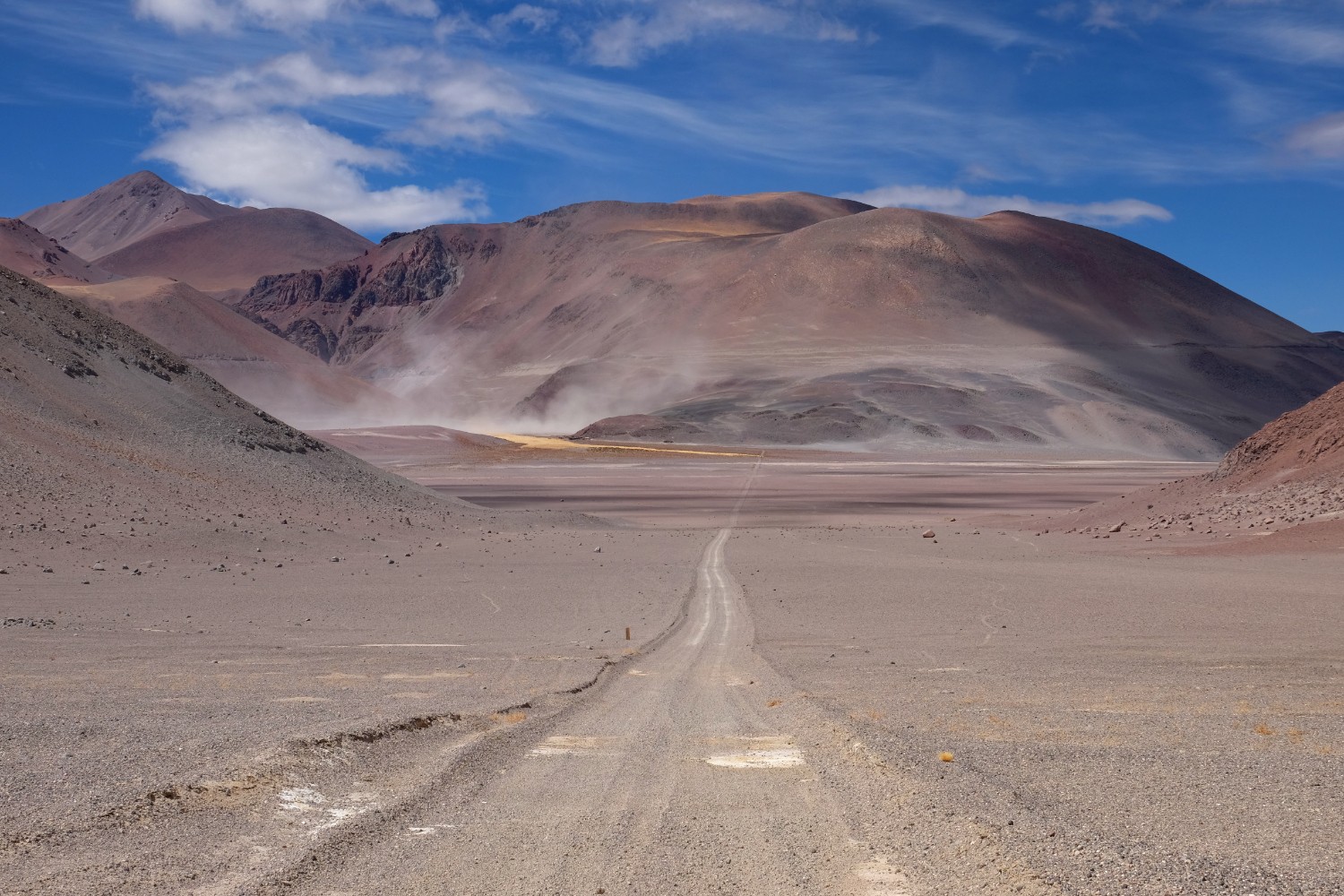
So similar to the Altiplano, you will come across evidences of our “living planet”. All in all this section is one of the most challenging ones I did throughout the whole weeks in the Altiplano/Puna region. I understand much better now why the “aleman muerto” basically died up there: this section is the home of the famous and deadly viento blanco that comes up from time to time. Besides all these challenges, the final descend from the mountains into the salar will provide you with amazing views.
Main Challenges:
- Strong Winds - I should write “super strong” winds since they were indeed insane on some days. On this section I encountered days where I only walked with 2 base layers of cloths + down jacket + hard shell - especially the latter was extremely useful in order to withstand the strong winds. I hardly used the hard shell I brought during the Altiplano section - but on this section it was an excellent choice. Keep in mind that strong wind + dust + sand will be an evil enemy. The scarf I used on the Altiplano trip was super helpful in these moments. Depending on the direction of the wind, it can be of great support in order to cover distance especially during climbs or it can make you hardly walk. It really depends on the direction - I heard that the wind comes mostly from the West, so from the Chile direction. But I also had headwinds on one day which took a lot of energy. Normally, the wind situation got better after sunset - but then temperatures will drop quickly towards -10/-20.
- Sun and Solitude challenges remain the same as in Section 1 except for the chance to have a cloudy sky and no warm/hot days.

-
Manage your water/food supplies - you need to resupply at the border with water and make sure that you have enough food left for the next 130 km. Section 2 will eat a lot of energy - especially due to the constant up-and-down and the cold weather conditions. In regards to water, I checked some of the GPS coordinates from the bicycle community but didn’t actually rely on them since I resupplied with around 20 liters at the border which was totally sufficient to reach Tolar Grande.
But – just in case:
- The soldiers told me that there is drinking water available also at the Laguna Socompa, however on the opposite side of the trail. I didn’t check it out and hence don’t have any GPS coordinates.
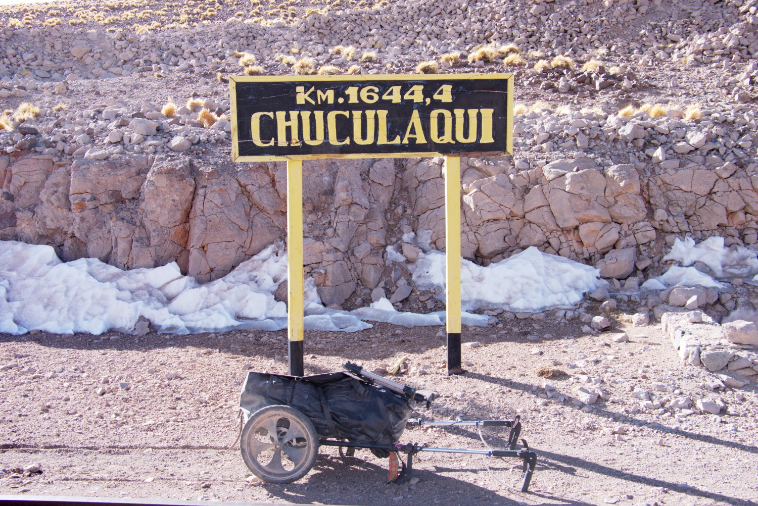
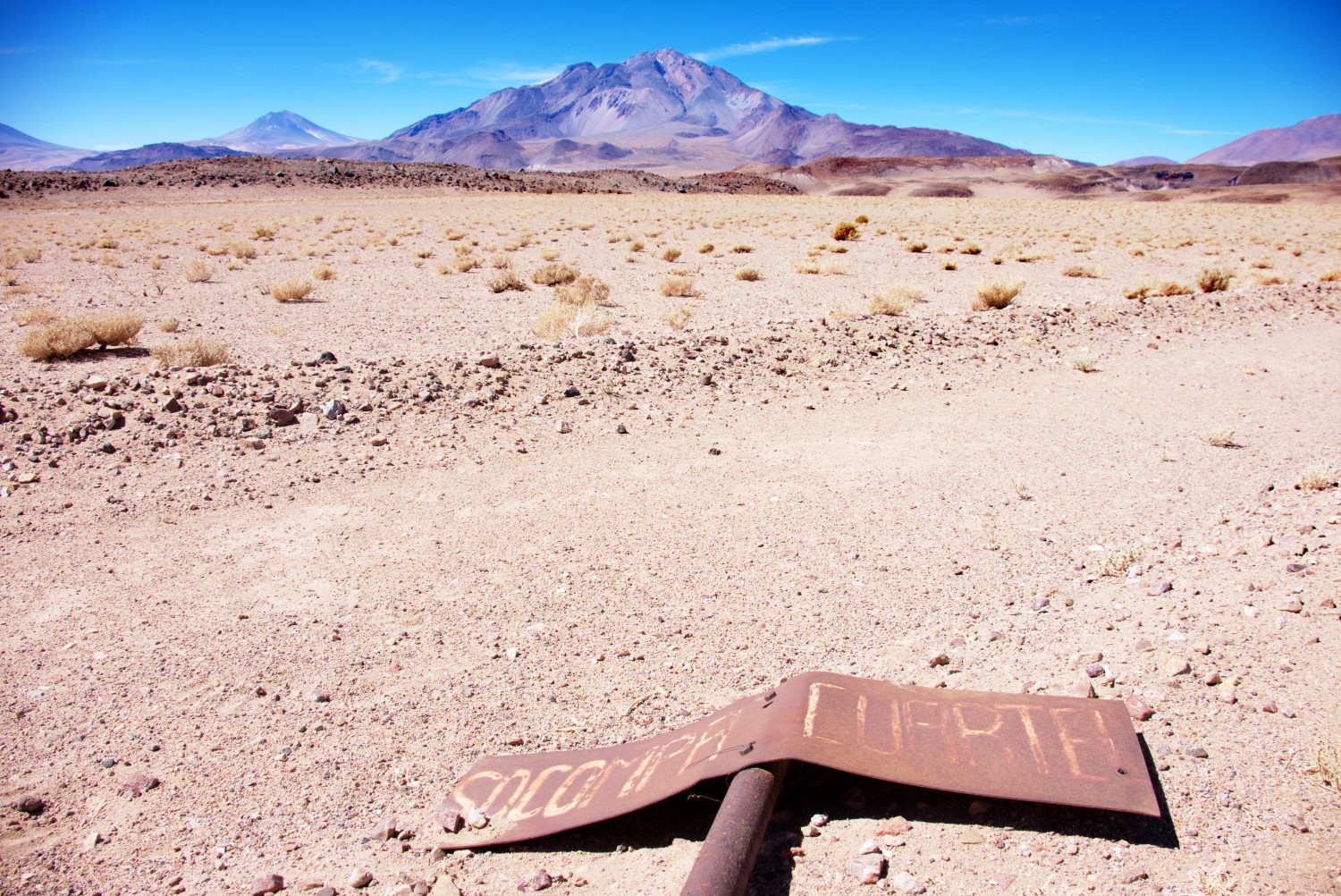
- The GPS coordinate for a well at the Chuculaqui station was dry! This one:
-24.74763, -68.0618. I saw some potential source more uphill from this point but didn’t check it. - I neither checked the GPS coordinate for the well at Caipe Station:
-24.69206, -67.98768. However, I heard that at least one of these sources should work - unfortunately I cannot confirm / deny this hypothesis.

Further Tips:
- Try to sleep in abandoned houses or shelters in order to get some protection from the elements. You will find plenty of them as soon as you leave the tomb of the aleman muerto behind:
-24.73289, -68.09852. - As soon as you reach the Salar de Arizaro, you will be able to cover greater distances in one day due to a flat and solid trail surface.
- Use short cuts via the railroad on the way down to the salar.
- Check out the tomb of Karl Wilmer, the aleman muerto, here:
-24.73289, -68.09852 - If you want to extend this trip, you can alternatively follow the railroad tracks to Tolar Grande instead of taking the 4x4 trail. Start at the Caipe station.
- I got picked up by the Argentinian military / administration in the middle of the night in the salar. Some folks from a mining company saw me obviously during the day and send a satellite message to the local administration in Tolar Grande. The reasoning from the locals is simple and makes sense to me: People by foot in the desert are normally in trouble and need help since nobody is hiking in this area. Although I didn’t need any support, I got a free ride for the last kilometers to Tolar Grande and had a chat with very friendly and helpful people from the military / administration. I was really impressed that these people took the message from the mining folks seriously and went out searching for me. This is not normal in South America.
- Theoretically, there is a bus from Tolar Grande to San Antonio de los Cobres - hitch hiking will also work but plan some time since this is a small desert village with limited traffic.
Potentially useful GPS Coordinates
- Peine - last chance to resupply with water/food:
-23.68015, -68.07342 - Monturaqui Station - abandoned old houses but water is available - can’t say anything about the quality so filtering is heavily recommended:
-24.34325, -68.43785 - Short Cut Start - Get on railroad tracks:
-24.16428, -68.46683 - Short Cut End - Get off the railroad tracks back on the 4x4 trail:
-24.30095, -68.4533 - Socompa Border Control - Chile military:
-24.45058, -68.29052 - Aleman Muerto - the tomb of Karl Wilmer:
-24.73289, -68.09852 - Chuculaqui Station - dry water well at abandoned railroad station:
-24.74763, -68.0618 - Caipe Station - abandoned railroad station with potential water source:
-24.69206, -67.98768 - Tolar Grande - small desert village with hostel and possibility to resupply with water/food:
-24.58937, -67.39356
Links for Additional Information
- https://velofreedom.bike/2014/11/19/puna-dreams-pt-1-the-blissful-solitude-of-socompa/
- http://andesbybike.com/chile/routes/paso-socompa-san-pedro-salar-de-pocitos/
- https://theridesouth.com/2015/02/04/the-puna-double-cross-pt-2-paso-socompa/
- https://fatcycling.wordpress.com/2015/11/26/an-argentinian-gateway-paso-socompa/
- http://phys.org/news/2009-03-earth-highest-microbial-fueled-volcanic.html
- http://www.colorado.edu/today/2009/03/03/highest-known-microbial-ecosystems-earth-fueled-volcanic-gases-says-cu-boulder-study
- https://www.wired.com/2009/03/nearmarslife/
- https://www.volcanodiscovery.com/socompa.html
- http://www.spiegel.de/reise/fernweh/suedamerika-per-motorrad-seemannsgrab-in-der-wueste-a-714136.html
- http://www.dangerousroads.org/south-america/chile/4312-paso-socompa.html
- http://cronicasehistoriasferroviarias.blogspot.com.ar/2010/05/estacion-socompa.html
- http://www.gendarmeria.gob.ar/pasos-chile/socompa.html
Conclusion
Crossing the Puna de Atacama over the Andes by foot, solo, is a unique, once-in-a-lifetime experience that I’m very grateful for. Although it was rough and exhausting, every meter was worth it and I would absolutely do it again.
The story around the aleman muerto is fascinating and I spend a lot of time on the trail to think about the differences between this poor fellow and myself. The main difference was basically the technological advantage I had. I brought proper equipment such as sleeping bag, warm clothes, enough water/food etc. He was wearing a suit according to what I heard and didn’t have any additional equipment that could protect him from the whiteout he got in. Additionally, I think it was also bad luck for him since I was in the area basically at the same time of the year: end of August vs beginning of September. I had relatively good weather conditions while he encountered a whiteout. But even in case he would have survived the storm, a long way would have laid in front of him with plenty more challenges: crossing the Andes to Chile, then crossing parts of the Atacama until he reaches the ocean. This was definitively a high risk trip in the 1930s.
As a conclusion I can say that hiking the Altiplano and the Puna in South America is not a walk in the park - it’s rough, special, and requires a lot of power of endurance - but it’s doable! More importantly, it needs proper preparation and especially to be honest with yourself: If you get sick due to the altitude, get down! If you run out of water, get to the next place with water immediately! If you think you didn’t pack enough warm clothes, review the list again and pack some more.
Don’t argue with yourself too much if the case is serious - don’t let your ego succeed. Arguing with your ego is a difficult task especially if you have a strong emotional relationship with the trip and you are motivated to go out and do it. But there is no place for heroes on the Altiplano. Not controlling your emotions and your ego in such cases could end up badly for yourself.
Compared with all the other desert hiking trips I did throughout the last 15 years in Jordan, Egypt, Israel and Syria, the Altiplano / Puna region is the most special one. It’s not simply a desert - it is a desert combined with the altitude of the Mont Blanc and some arctic-like weather conditions.
Pictures