El Chalten is an upcoming (if not already) hot spot for tourism and on the edge to become a mainstream place-to-be in Patagonia. Nevertheless, not yet a McDonald’s restaurant can be found there so I can still recommend to pay a visit to this lovely spot close to El Calafate.
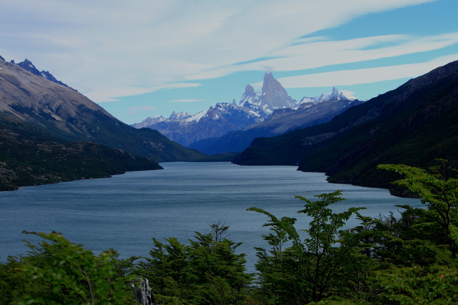
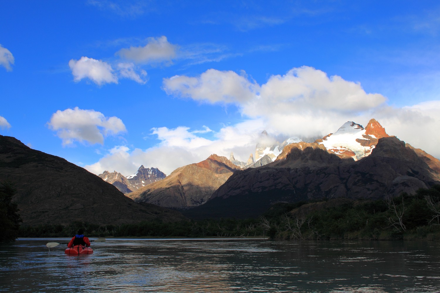
The “Rio de las Vueltas” is already a known place to packrafters from around the globe and you can find more information about rafting trips on this river here and here. It’s a nice river without big challenges (as of FEB 2015) but with awesome views on the Cerro Torre and easy to be accessed.
Caution: This trip contains a border crossing that is not possible / allowed according to local Chile Border Police. Therefore, please do review the situation with authorities from Argentina and Chile before you follow instructions below. It is clearly NOT recommended to follow our path again without previous engagements with authorities - more information below.
Tour Information
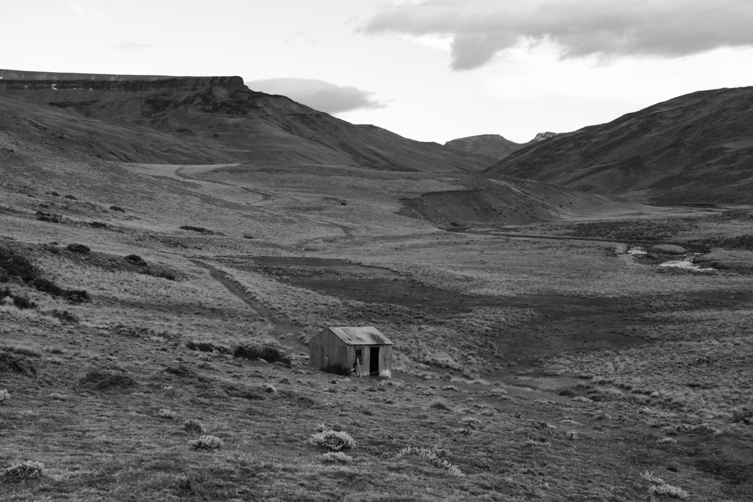
We kicked this trip of in February 2015, 2 people, with a total of 2 weeks spent down in Patagonia. The trip has been mostly individually created, putting together existing trails and unmarked land that needed to be crossed. Therefore, there is no no official place to resupply until you reach the Laguna del Desierto which has a kiosk. This means: you need to carry all your food from the very first beginning on unless you want to ask/pay locals that you potentially meet on the trail. Exception: You can rest at “Estancia El Condor” if you have the required $$$ - this is not a cheap, low level spot, but a nice and expensive one including hot showers and good food: -49.08406, -72.55115. The estancia also rents horses.
We took the bus from El Calafate to El Chalten but asked the driver to drop us way before El Chalten on the road right beside Lago Viedma: -49.576, -72.33772. From there we traversed the mountains towards north until hitting the road near Lago San Martin: -49.19186, -72.36147. For the traverse: We didn’t follow any official trail (is there any?, hence, you need to prepare the right trail based on GMaps/BingMaps/Gaia/OpenStreeMaps - the area up there is quite lonely but not too difficult to cross. It took us in total around 2 days to cross it. Reaching the gravel road, you can head north-west towards the border to Chile - the police station where we got our exit stamp for Argentina is located here: -49.12608, -72.49215
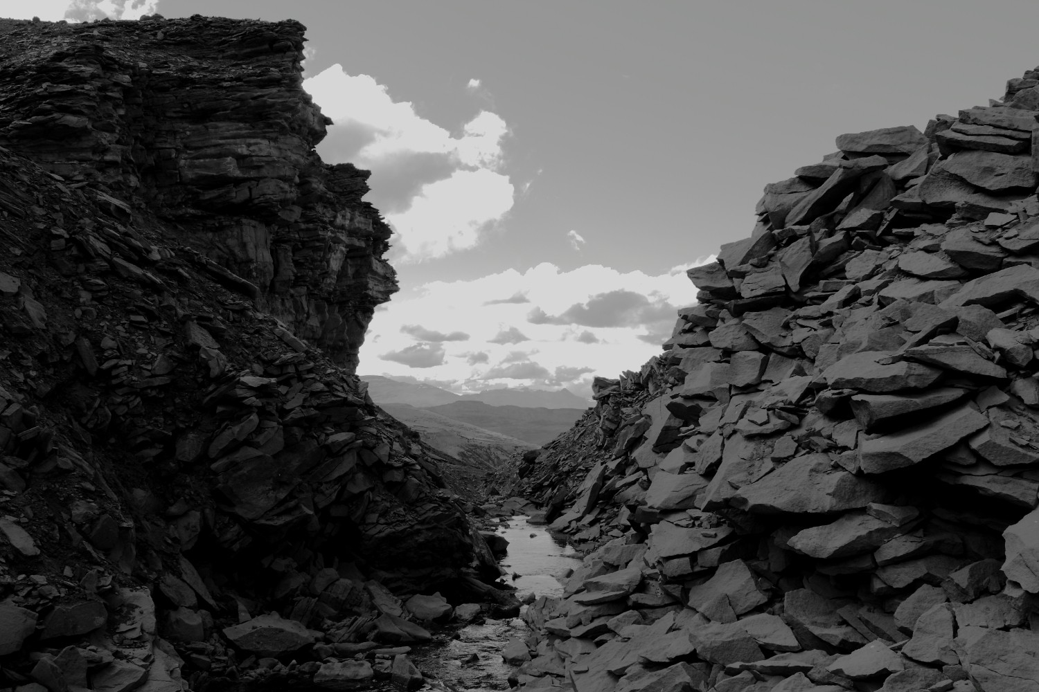
The border crossing trail requires to cross one river and also takes some time since it’s not a well marked / maintained trail. We also lost the way several times in the swampy area around here -48.91854, -72.63549. This border crossing is listed in various official maps of this area (please read statement below)
Caution: The border crossing we did from Argentina to Chile caused us a lot of issues at the Chilenean border police in Lago Ohiggins (
-48.86929, -72.74208). We basically got stuck there for 1 day since Chile did not accept the exit stamp from Argentina border police. I strongly do NOT recommend to cross the border (-48.89705, -72.69654) via the path we took without previous engagements with both Argentina and Chile border police although locals could tell you otherwise.
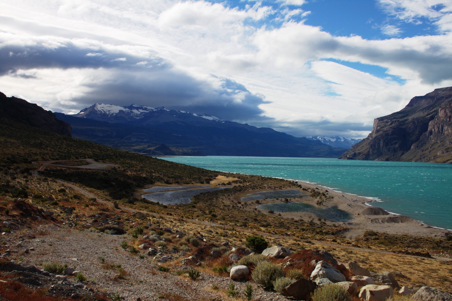
Once finishing all formalities with the Chile border police in Lago Ohiggins, you can head south towards Laguna del Desierto. You can also extend the trip by heading north-west and then south-west to Lago Chico. There is plenty of material on the web for these kind of extensions. You can also take the boat and head up north to Villa O’higgins in Chile.
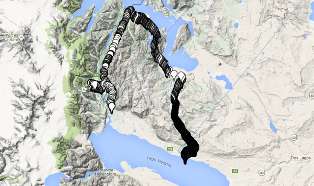
You can walk or take the boat to cross the Laguna del Desierto until you reach the camping space at the southern end: -49.08282, -72.89224. We inflated our packrafts near this place for convenience purposes: -49.10253, -72.90485. Be aware that there are some waterfalls upstream that you cannot raft according to our information. From there, you can easily float down to El Chalten in 2 days or even less depending on the speed of the river.
Difficulties & Challenges
Be aware of the famous patagonian winds! Yes - they are strong and will have an impact on any packrafting attempts. On the Rio de las Vueltas, take care of potential barb wire in the river or on the shores which could harm you and your packraft. Additionally, consider the cautions mentioned above in regards to the border crossing - you can get into trouble easily otherwise.
Rio Electrico is a more challenging river - be aware and scout properly - the confluence with the Rio de las Vueltas can be found here: -49.23075, -72.91083 The walk upstream is recommended nevertheless - nice views!
Alternatives
If you bring your packraft, you could do the extra round to this peninsula: -49.03741, -72.48744. You can get back on the gravel road with packrafting this area here: -48.99103, -72.52555 until you reach the gravel road again. There is a trail on the peninsula that you can use and cannot miss. Take care of strong winds!
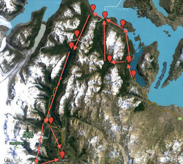
An interesting extension once you arrive in El Chalten: Circuito Cerro Huemul On the following image we investigated 2 potential alternatives for the route - both alternatives need to be investigated beforehand since I’m not completely sure whether the terrain allows them to be executed properly.
Pictures